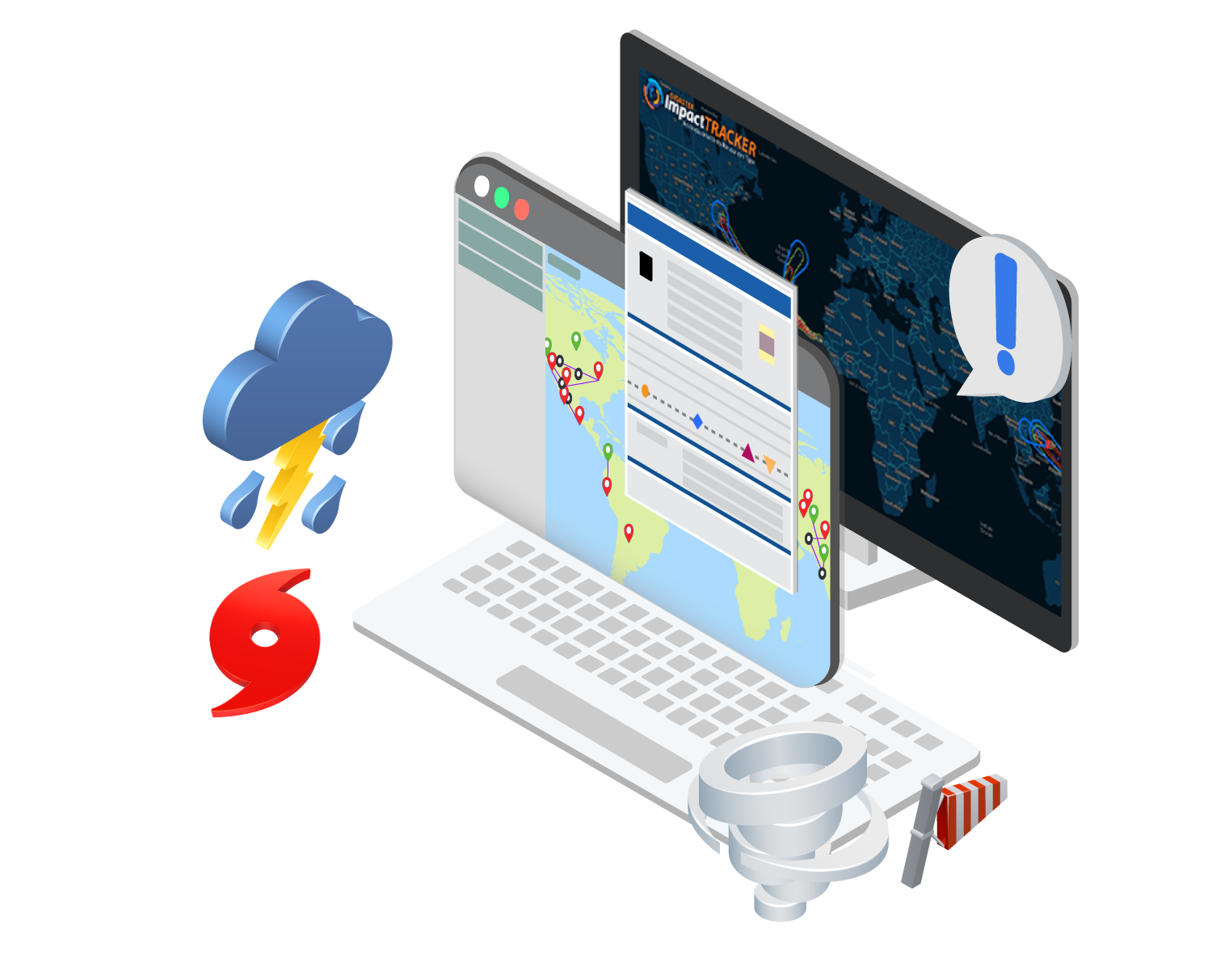
Track natural disasters, earthquakes, hurricanes and other weather-related events that are not only having a direct and immediate impact on operational plants, but also those plants or projects that lie in the projected path of the event. This allows for more effective contingency planning by plant owners, and the ability for OEMs and contractors to better plan and mobilize their resources, manpower and equipment to support plants being impacted.
Key Highlights:
The tool brings together real-time third-party global data from the Global Disaster Alert & Coordination System, the National Hurricane Center, Enflight and the National Data Buoy Center alongside IIR's geospatial mapping of almost 200,000 operational plants, 46,000 plants under development and 20,000 currently under construction projects globally.
 (Click image for an expanded view)
Site-wide Scheduled Maintenance for April 12, 2025, between 9 A.M. - 9 P.M. CST. During this time, all services will be unavailable periodically throughout the scheduled maintenance window.
×Contact Us
For More Info!